In honor of the flood victims, and to educate those who are not aware that our legacy of parks was bought with a terrible price, Friends of Rapid City Parks holds an annual Memory Walk on the anniversary of the flood, June 9-10, 1972.
This year’s event was to have taken place on Saturday, June 13, but like many local events, was canceled to avoid large gatherings during a pandemic. We hope you will take some time to learn about the history of the flood, its contribution to our park system, why preservation of the greenway along Rapid Creek is Friends’ top priority, and stop by the monument for a moment of remembrance of the 238 citizens who perished.
The Black Hills Flood of 1972 was the third-deadliest in U.S. history. It was also one of the costliest, causing $165 million in damage. The flood forever changed the look of the city; Memorial Park, a greenbelt that cuts through the heart of town, now occupies what was once another thriving neighborhood. People lived along Rapid Creek—and people died. The park was conceived as a tribute to those who perished that night, and named for Leonard Swanson, who served as city engineer and public works director. After the devastation of the flood, Swanson made an emotional plea to the City Council not to allow rebuilding in the “suicidal flood plain.” It’s a somber reminder of a night forever ingrained in the memories of long-time Rapid City residents…one that Friends of Rapid City Parks hope is never forgotten.
Flood history is accessible in three ways:
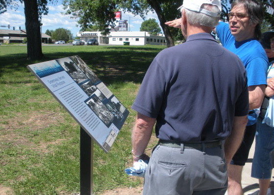
1. Take a walk or a ride along the Leonard Swanson Memorial Bike Path, and read the information on the more than a dozen interpretive signs installed at key points.
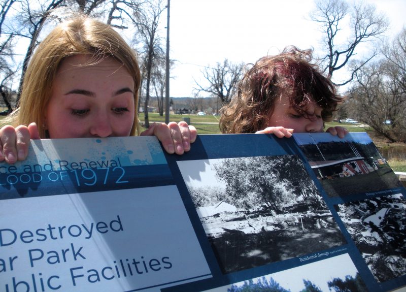
Interpretive signs along about flood history were developed and placed during the 40th anniversary observance in 2012.
Curtis Price, right, and Del Beck match today’s landscape with historic photos on interpretive greenway sign at Omaha and Mountain View.
2. Get more information by using a smart phone to access the QR Codes on the interpretive signs.
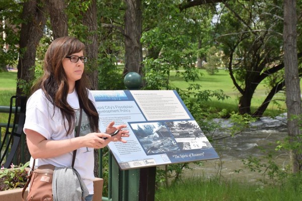
Samantha Slocum of the Rapid City Public Library explains how to access web-based information through QR codes on the bike path interpretive signs. The Library and Friends collaborated on developing and installing the codes along the bike path to give park users access to historical and current information about the greenway.
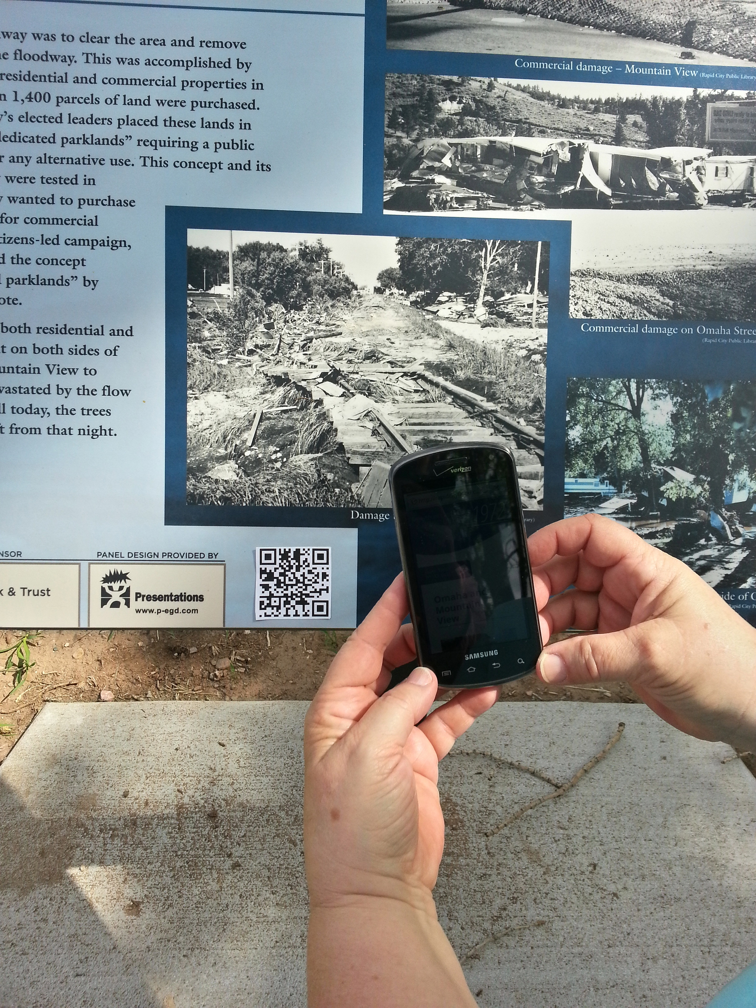
Scan the code with smart phone application to bring up information.
3. Download the free Avenza Maps application to your phone or tablet, to see historic photos of places along Rapid Creek just after the flood. Search in the Avenza store for “Friends of Rapid City Parks,” install the application and view comparisons like these.
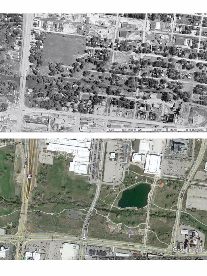
Memorial Park, days after the flood, and in 2019.

Jackson Park, days after the flood, and in 2019.
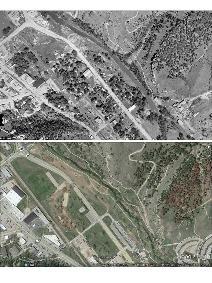
The Gap, days after the flood, and in 2019.